Projects
Sienna Property |
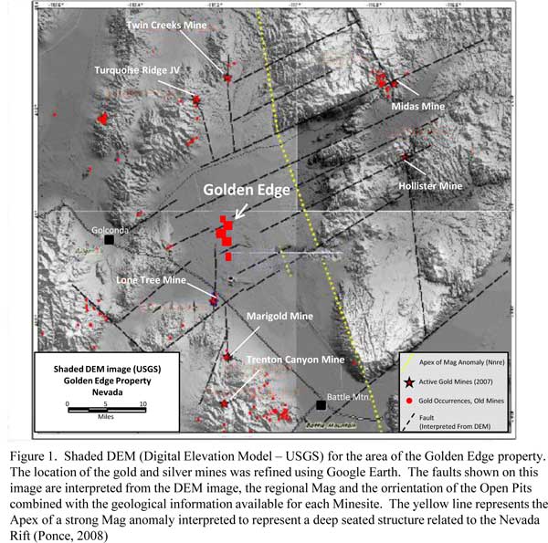
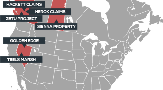
Golden EdgeLocation: Nevada, USA The Golden Edge property is located about 50 km east of the city of Winnemucca in north central Nevada. The property is located about 26 km SSE of Barrick's Turquoise Ridge Mine and 8 km NNE of Newmont’s Lone Tree mine (Figure 1). Exploration has been carried out from 1999 to 2004, and has included seismic, CSAMT, and gravity surveys as well as soil geochemistry. Three RC holes were drilled as recently as 2004 but did not reach target rocks at depth.
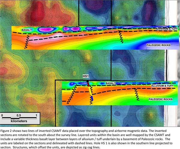
Golden Edge sits within the Battle Mountain-Eureka trend, a linear zone defined by the presence of gold+silver mines and occurrences in a variety of stratabound and stratiform replacement orebodies that are associated with the Paleozoic Antler Peak limestone. The gold, silver and base metal mineralization in the trend varies from massive sulphides such as at the old Fortitude Mine in the Cortez district, to distal gold dissemination in carbonaceous rocks as at the Marigold deposit. All of the gold and base metals deposits are intimately associated with structures and more importantly, areas of intersecting structures. The Lone Tree gold deposit to the south is associated with a north-south fracture zone called the Valmy fault zone, which is about 90 metres wide and dips 75 degrees to the west. This fault zone continues northward and can be identified by regional magnetics and gravity onto the western portion of the Golden Edge property as announced by the Company in early 2012. CSAMT surveys conducted by Zonge Geoscience, Inc. in 2001-2002 concluded that the depth to pre-Tertiary bedrock is likely to be at its shallowest beneath the eastern end of the survey lines (180-240m), potentially increasing to 450m or more at the western end. Similar results were obtained with a reflection seismic survey consisting of three lines totalling 3.035km. The east-west lines determined the depth to potential host rocks at 240-555m (Figure 2).
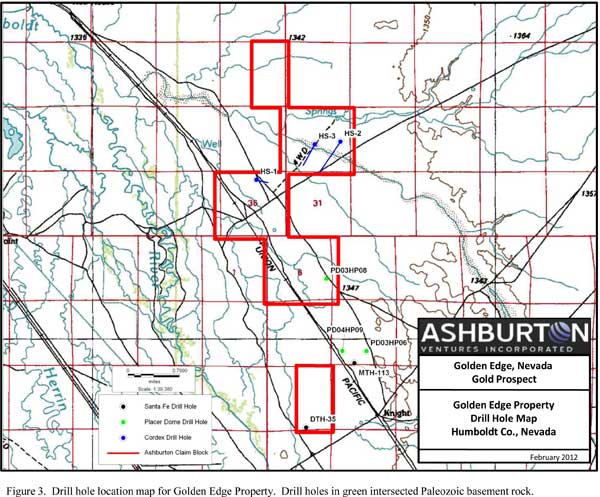
Three reverse circulation holes (~1,000m total) were drilled in 2002 (HS-1, -2, -3) but never reached the target lithologies. In 2003-2004, however, Placer Dome drilled three vertical reverse circulation holes and hole HP-06 may have encountered the Valmy Quartzite at a depth of 246 meters, with hole HP-09 intersecting Antler Sequence rocks (Edna Mountain formation sandstone & siltstone) at 169 metres (Figure 3). Hole HP-06 also showed a steady increase of gold in water from 2.04 ppt at 54 metres to 89.95 ppt at 251 metres. Only five cuttings samples from these RC holes, taken over five-foot intervals, were assayed with gold values from 9-13 ppb.
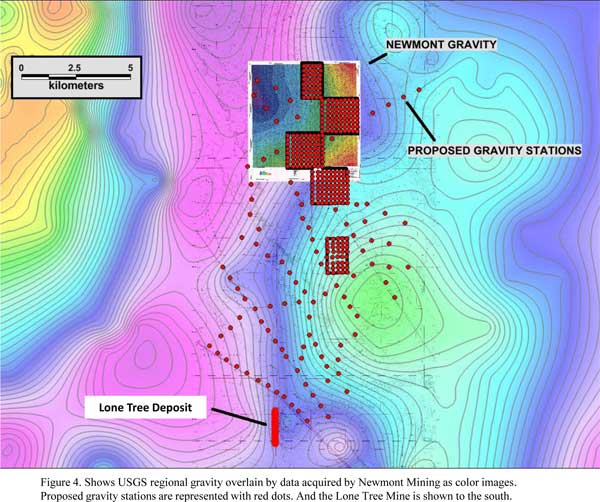
In 2012, Ashburton conducted a review of historical geophysics for Golden Edge and identified strong evidence for the continuation of the Valmy structure onto the property. Figure 3 shows the USGS regional gravity overlain by data acquired from Newmont Mining. The 2012 gravity data collection stations are represented with red dots. Mineralization at the Lone Tree deposit, located just south of Golden Edge, is controlled by a series of north-south trending structures referred to as the Valmy Fault Zone, with down to the west movement. The USGS gravity data reveal a gradient extending northward from Lone Tree into the Golden Edge property. Several possible apparent right lateral shifts or bends move the gradient eastward, indicating structural complexity. A higher resolution gravity survey was completed in February 2012, with the intent to identify favourable target areas for drilling in mid-2012. Proposed gravity stations, (shown as red dots on Figure 4) were positioned to track the gradient northward from the Lone Tree Mine into the Golden Edge property. To provide greater detail, gravity stations within the property were positioned on a grid of 200m spacing. Interpretation of the 2012 gravity survey data is still pending.
Golden Edge was optioned from Premier Gold Mines Limited (TSX:PG) in 2011, with Ashburton establishing a 50%-50% joint venture agreement with Premier by completing a $750,000 year-one work commitment that includes at least $500,000 directed toward drilling. An additional $2,250,000 in exploration expenditures is required over year two and three to complete the 50% interest in the property. |